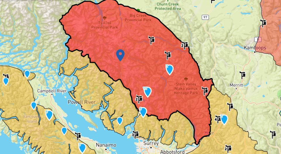
With heavy rain expected for Whistler and the Sea to Sky on Saturday, Avalanche Canada is warning of increased risk in the backcountry.
The avalanche danger rating is currently high for the region, and a rainfall warning is in effect for Squamish to Whistler, with 50 to 70 mm expected by the afternoon.
"Avoid avalanche terrain during periods of heavy loading from new snow, wind, or rain," Avalanche Canada said on its website Saturday morning.
The avalanche danger is forecast to drop back to "considerable" by Sunday, and "moderate" on Monday.
"Many winter enthusiasts in the Sea to Sky have delighted in some good early season exploration. Strong storms rolled through in late November, and by early December the snowpack reached nearly 150 centimetres at treeline near Whistler. The prevailing mindset has been to embrace the conditions while they last, knowing things can change quickly," Avalanche Canada said in its weekly backcountry update on Tuesday afternoon, Dec. 5.
"Indeed, they did. Earlier this week, unseasonably warm weather swept in. A strong southwest flow brought several days of mild air temperatures and sustained high freezing levels. Treeline air temperatures soared, accompanied by clear skies. This warm spell destabilized the recent snow and accelerated settlement in the snowpack. Small, sun-induced, wet, loose avalanches were observed, especially on steep, sun-exposed slopes. Additional signs of instability such as tree bombs, pinwheels, and moist spring-like snow surfaces highlighted the atypical December weather.
"Fortunately, the only constant in life is change! An atmospheric river-like flow should bring precipitation to the South Coast through the weekend. While weather models differ in the exact impact for the Sea to Sky region, strong wind, moderate freezing levels, and heavy precipitation are likely. Avalanche danger is expected to rise as the storm develops. It could be a great time to enjoy the recent snowfall at the resort, or even to relax by the pool if rain hits the mountaintops. Be sure to check the latest avalanche forecast and weather updates for detailed insights into the storm’s progression.
"As the storm subsides, the lure of exploring in the backcountry could be strong. However, early season conditions demand caution. Avalanches at this time of year are especially dangerous due to limited snowpack depth and potential injuries from exposed rocks and ground roughness. As usual, check the forecast at avalanche.ca before venturing into the backcountry and consider submitting a Mountain Information Network (MIN) report to share local conditions."
Skiers and boarders are reminded backcountry conditions can change rapidly, and to always check for the most current conditions before heading out into the backcountry. Daily updates for the areas adjacent to Whistler Blackcomb are available at 604-938-7676, whistlerblackcomb.com/mountain-info/snow-report#backcountry and avalanche.ca.


