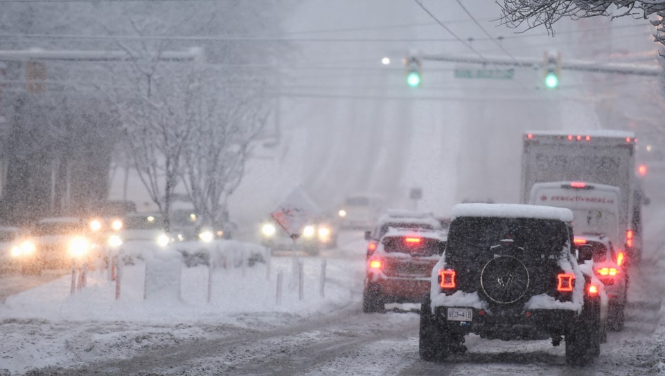
Metro Vancouverites should brace for a snowy commute in some areas on Wednesday, Feb. 5 evening.
Environment Canada has issued a special weather statement for parts of southern and eastern Metro Vancouver, warning of the potential for significant snowfall accumulations.
Meteorologist Alyssa Charbonneau told V.I.A. that a weak low-pressure system lingering off the south B.C. coast continues to bring moisture to the region.
On Tuesday, the national weather agency expected the moist system would primarily target areas south of the Canada-U.S. border. However, bands of convective flurries are expected to spread over parts of the Lower Mainland on Wednesday evening and overnight into Thursday.
Two to 4 cm of snowfall is possible in Delta, Surrey and Langley, Coquitlam, Maple Ridge, and the western Fraser Valley, including Abbotsford and Mission. However, local snowfall accumulations may exceed 5 cm, Charbonneau explains.
Other parts of Metro Vancouver, such as the city of Vancouver, Burnaby, and Richmond, may see up to 2 cm or light flurries.
"Downtown Vancouver could see flurries while eastern parts of Vancouver could see up to 2 cm," she notes.
Next week's Metro Vancouver weather forecast includes more snowfall
Charbonneau says a great deal of uncertainty is associated with the low-pressure system because it is a convective airmass that brings moisture to specific areas.
"This is a very localized heavy snow that develops; it's not a big system that brings everything uniformly...it has variable amounts," she explains.
Locally heavy flurries could reduce visibility on roads, impacting the evening commute. Drivers should allocate extra time for travel and adjust their driving as road conditions change.
"The snow might hit in rush hour. Leave time to get where you are going since it is cold and the roads are icy. Snow falling could quickly accumulate," she notes.
Wednesday's snow event isn't expected to produce similar amounts to the ones experienced on Sunday but it may continue through the night.
Friday's forecast looks dry but Saturday night's forecast includes another opportunity for snowfall as a weak low-pressure system comes down the B.C. coast. The cold Arctic airmass is expected to remain in the Lower Mainland through at least mid-next week, allowing opportunities for snowfall anytime moisture makes its way into the region, Charbonneau describes.
While some models indicate temperatures will fall to a bone-chilling -8 C on Monday night (without the wind chill), the meteorologist says the temperature forecast is uncertain this far out.
"There is some divergence in the forecast models of just how cold it is going to get...but the colder-than-normal conditions will persist."
Stay up-to-date with hyperlocal forecasts across 50 neighbourhoods in the Lower Mainland with V.I.A.'s Weatherhood.


