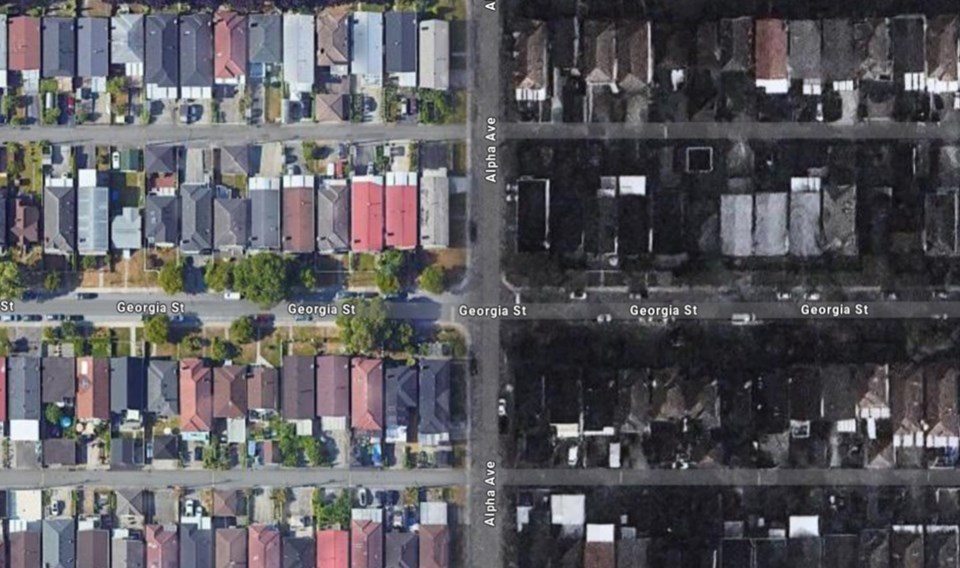
If you’ve looked at Burnaby with Google satellite view lately you might be forgiven for thinking the gloom of Mordor has settled over it in the last few days.
While a north-south strip of the city closest to Vancouver still appears in crisp, colour images, a wide, vertical swath running down the middle appears in a blurry, post-apocalyptic black and white.
The eastern half of Burnaby appears in a muddy sepia that dissolves into pixels when you zoom in.
“It literally (looks) like a fire went through and burnt everything,” stated a post on Reddit. “The image quality is literally hazy. Trees are almost black. It's shocking tbh.”
The low-quality images extend into Coquitlam, North Surrey and New Westminster.
Reddit users say the poor quality images have affected the satellite map view in their vehicles’ navigation systems.
Google Earth for desktop does not to appear to be affected, and selecting Globe view in Layers at the bottom left of the map allows you to view satellite images of Burnaby without the ominous pall.
In response to questions from the NOW, Google said it has recently changed its process for satellite imagery publication, enabling the company to show "significantly fresher, up-to-date imagery in more than 20 countries around the world."
"In some places these changes have resulted in a slight reduction in image quality or resolution," read an emailed statement from Google. "We are working to improve image quality and to filter out any cloudy or blurry imagery from the satellite layer."
Google did not say when the issue in Burnaby would be resolved.
Poor quality satellite imagery update for Google Maps in Metro Vancouver area
byu/tccool invancouver
Follow Cornelia Naylor on X/Twitter @CorNaylor
Email [email protected]


