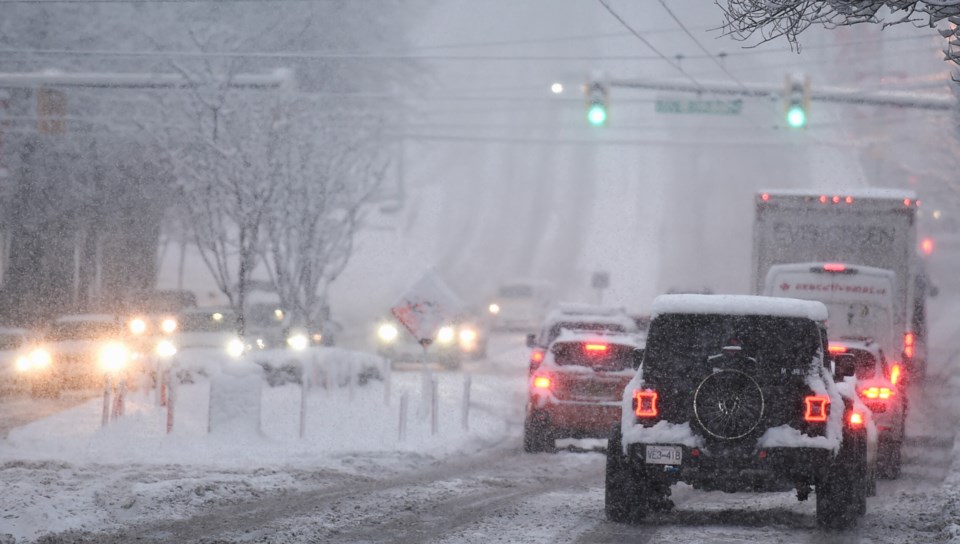
A winter storm could wallop the Lower Mainland with up to 30 cm of snowfall this weekend.
Environment Canada Meteorologist Alyssa Charbonneau told V.I.A. that Saturday, Feb. 1 will be cool with isolated snow showers that could get heavy with minor accumulations but no significant snowfall is expected.
"We're really looking at the period of late Sunday afternoon and into Monday morning," she added. "We may have a better chance of seeing widespread snow in metro Vancouver."
The department is "closely tracking" a frigid Arctic air mass from the Yukon as it moves from the B.C. interior into the Lower Mainland. When the cold air mass clashes with a moist, low-pressure system moving inland from Vancouver Island, snow will start to accumulate.
"All the ingredients for low-elevation snow are there but too far in advance to give exact details," she explained. "Where the two air masses clash is where we will see the snowfall."
Metro Vancouver weather forecast could include up to 30 cm of snow
Charbonneau says it is difficult to determine exactly where the heaviest snow will develop this far ahead of the event. However, anywhere from five to 30 cm of snowfall is possible as the Arctic air meets the moist air mass.
"We shouldn't all panic right now...we might not see much of anything but it is a situation where we should be prepared," she noted. "Get your shovel out if you're going to be on the road."
Strong Arctic outflow winds from gusting the Fraser Valley could make freezing temperatures feel even cooler heading into next week.
"In an Arctic outflow situation, cold dense air from the Fraser Valley flowing offshore can blow snow in traffic and reduce visibility," she said.
The chance of snow is expected to diminish by Monday evening as a ridge of high pressure replaces the low pressure system.
"There's lots to be aware of if you are out and about. Keep a close eye on the forecast."
Stay up-to-date with hyperlocal forecasts across 50 neighbourhoods in the Lower Mainland with V.I.A.'s Weatherhood.


