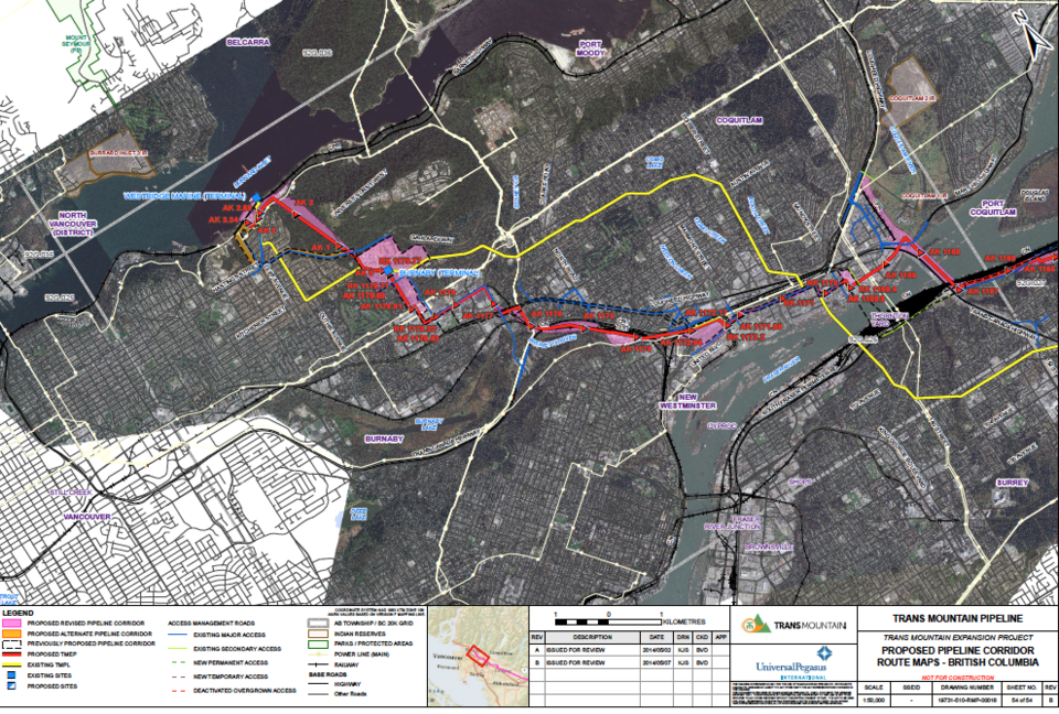
Details of Kinder Morgan’s latest preferred route for the Kinder Morgan pipeline expansion are finally becoming clear.
On Tuesday May 14, Kinder Morgan added thousands of new pages, including revised route maps, to its National Energy Board application.
According to the new documents, the latest preferred route cuts through South Burnaby along the CN tracks close to Brunette River.
In North Burnaby, it appears the expanded pipeline will travel through the southern corner of the Burnaby Mountain Conservation Area before terminating at the Westridge Marine Terminal.
With the proposed route, some Burnaby residents who live on the west side of Burnaby Mountain will be boxed between the existing line and the proposed line.
The deadline to apply as an intervenor was Feb. 12.
“This stuff is buried on the National Energy Board website. It is not like there are billboards or mailings to your house. You could find out that your property or your business or your school is going to
be affected by this,” said Burnaby-Douglas MP Kennedy Stewart.
Kennedy argued that the NEB should not have allowed the deadline for intervenors to pass before the proposed pipeline route was clear.
“The two things is that the application was really rushed by the company and that the National Energy Board process is a total joke,” he said.
The previously preferred route saw the pipeline run down Lougheed Highway and then through the tank farm and close to Cliff Avenue.
Kinder Morgan’s Greg Toth, senior project director, said the routes submitted to the NEB are not new but are in fact previous alternative or study routes.
“The clarification we provided through our recent response to the National Energy Board information request, it has been consistent all along in that the corridors that we’ve been looking at – right
from the application and our previous engagements efforts we filed,” he said.
“Our proposed corridor was to route down Lougheed Highway with an alternative corridor following the CN-Highway 1 corridor and similarly for our Burnaby terminal to Westridge. Our proposed corridor was following (Burnaby) Mountain Parkway to Hastings down North Cliff, but we had an alternative that was a trenchless alternative through Burnaby Mountain Conservation area.”
“We proposed … what we called a proposed study corridor, but in both cases because of the uncertainties and a lot of the criteria that have to be looked at we carried an alternative.”
The Lougheed Highway route option has been completely taken off the table.
Toth said the interactive map on the Kinder Morgan site will be updated.
Toth said the location of the line won’t be known for about 15 months while the routing process continues and more geotechnical research is done on the route through the mountain, but it will fall within the 150-metre-wide area of the study corridor.


